


VTD precinct A9, Marshall County, South Dakota
About
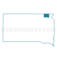
Outline

Summary
| Unique Area Identifier | 667530 |
| Name | VTD precinct A9 |
| County | Marshall County |
| State | South Dakota |
| Area (square miles) | 258.25 |
| Land Area (square miles) | 255.64 |
| Water Area (square miles) | 2.61 |
| % of Land Area | 98.99 |
| % of Water Area | 1.01 |
| Latitude of the Internal Point | 45.74050720 |
| Longtitude of the Internal Point | -97.84438960 |
Maps


Graphs
Select a template below for downloading or customizing gragh for VTD precinct A9, Marshall County, South Dakota


Neighbors
Neighoring Voting District (by Name) Neighboring Voting District on the Map
- Sargent 26-03 Voting District, Sargent County, ND
- Sargent 26-04 Voting District, Sargent County, ND
- VTD-Britton ward 3, Marshall County, SD
- VTD-precinct 20 SDetroit-ClaremontTwp-ClaremontCity, Brown County, SD
- VTD-precinct 21 Lbrt-Hcla-Prt-Grnld-Lnsg-Nth-DtrtTwp-HclCy, Brown County, SD
- VTD-precinct A4, Marshall County, SD
- VTD-precinct A5, Marshall County, SD
- VTD-precinct A6, Marshall County, SD
- VTD-precinct A7, Marshall County, SD
- VTD-precinct A8, Marshall County, SD
Top 10 Neighboring County Subdivision (by Population) Neighboring County Subdivision on the Map
- Weston township, Marshall County, SD (228)
- Miller township, Marshall County, SD (219)
- Stena township, Marshall County, SD (192)
- Lake township, Marshall County, SD (173)
- Pleasant Valley township, Marshall County, SD (168)
- White township, Marshall County, SD (122)
- Claremont township, Brown County, SD (121)
- Newark township, Marshall County, SD (109)
- La Belle township, Marshall County, SD (70)
- Newport township, Marshall County, SD (68)
Top 10 Neighboring Unified School District (by Population) Neighboring Unified School District on the Map
- Sisseton School District 54-2, SD (7,853)
- Britton-Hecla School District 45-4, SD (3,149)
- Sargent Central Public School District 6, ND (1,530)
- Langford School District 45-2, SD (1,195)
Top 10 Neighboring State Legislative District Lower Chamber (by Population) Neighboring State Legislative District Lower Chamber on the Map
- State House District 2, SD (21,657)
- State House District 1, SD (20,515)
- State House District 26, ND (12,887)
Top 10 Neighboring State Legislative District Upper Chamber (by Population) Neighboring State Legislative District Upper Chamber on the Map
- State Senate District 2, SD (21,657)
- State Senate District 1, SD (20,515)
- State Senate District 26, ND (12,887)
Top 10 Neighboring 111th Congressional District (by Population) Neighboring 111th Congressional District on the Map
Top 10 Neighboring Census Tract (by Population) Neighboring Census Tract on the Map
- Census Tract 9508, Marshall County, SD (4,656)
- Census Tract 9520, Brown County, SD (4,412)
- Census Tract 9742, Sargent County, ND (2,382)
Top 10 Neighboring 5-Digit ZIP Code Tabulation Area (by Population) Neighboring 5-Digit ZIP Code Tabulation Area on the Map
- 57430, SD (2,243)
- 57270, SD (904)
- 57454, SD (558)
- 57446, SD (472)
- 57432, SD (465)
- 57247, SD (320)
- 58017, ND (313)
- 57421, SD (88)